As part of my PhD I spend several months a year in Svalbard’s outdoors honing my drone flying skills, acquiring data to reconstruct Svalbard’s exposed outcrops digitally, and coming up with a set of robust best practices for the acquisition and digitalisation of outcrops (see the online Geo-UAV and Geo-SfM tutorial pages). This resulted in the digitalisation of several hundred outcrops in Svalbard to date that are accessible through the Svalbox Digital Model Database (DMDb), discussed in our recent Geosphere contribution and visualised on https://www.svalbox.no/map. Herein open and FAIR access is guaranteed to both input data and processed results alike.
As not many such databases exist, let alone with open data policies, we took the first steps to establish a digital model database and framework that target key outcrops in the Swiss Alps last year. After a very successful campaign then – of which the results are showcased in Betlem et al. (2023) – I this year returned to Switzerland’s Graubunden area for campaign number 2 supported by DEEP’s travel grant.
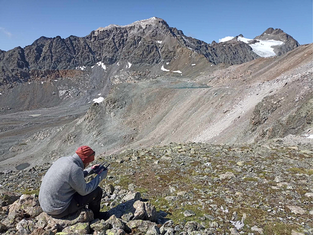
The mapping and investigation of subsurface features are integral to the geosciences, and important aspects of de-risking geological carbon sequestration plays that are vital to mitigating anthropogenic climate change. Given that access to the subsurface is often difficult, outcrops hold incredible value as analogues. Outcrop-based analogue studies provide clues about what is happening in the subsurface and can be used to predict processes therein, thus are key to our understanding of it. Increasingly, unmanned aerial vehicles (UAVs), or drones, have become the de-facto tool for the mapping of outcrops. Not only do they provide unique viewing angles and birds’ eye views, but drones are also highly effective at acquiring data across larger areas and inaccessible localities. Further, drone-based photographs can be digitally processed into highly detailed, three-dimensional digital reconstructions of outcrops through a process known as photogrammetry – a technique central to my PhD based at the University Centre in Svalbard.
Digitalised outcrops are commonly known as digital outcrop models (DOMs). DOMs are complementary to field observations in that they provide a means to revisit field sites digitally, even long after the loss of the physical locality or outcrop. As three-dimensional replicas, DOMs facilitate the extraction of structural measurements, the quantitative characterisation of outcrops, and can be directly integrated into geomodelling workflows, e.g., reservoir modelling studies, and even geophysics. It is thus unsurprising that DOMs are increasingly seen as a fundamental part of field-based geoscientific research and even education.
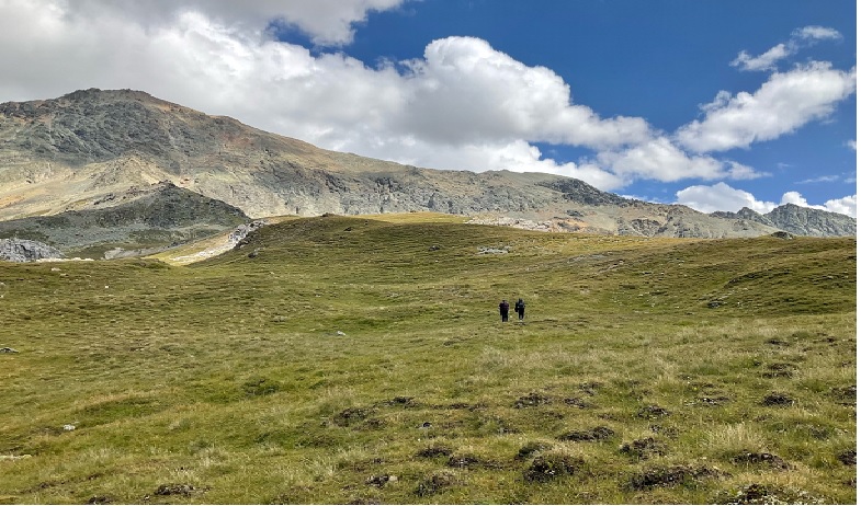
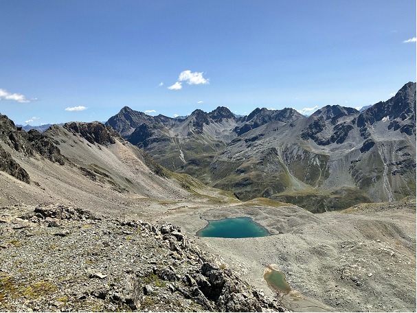
In Switzerland, the targeted localities comprise all peaks that contain outcrops that expose large-scale extensional detachments of rift systems that are associated with the Late Jurassic opening of the Alpine Tethys, some 165 million years ago. As seen in the field photos, many of the outcrops are exceptionally exposed, albeit often quite inaccessible (and thus well suited for drone-based data investigations).
The targeted outcrops all lie at altitudes of around 3000 m above sea level, meaning a good 1000 m elevation gain to reach them from the valleys that cut through the mountains and are often situated at least 10 km away from the nearest roads. In other words, reaching the localities can be quite a challenge, especially with 20 kg backpacks filled with drones and batteries. Luckily on one of the longest days, Helibernina, a local helicopter operator, provided a ride to the top of Piz Laviner, the locality by far the furthest away from any parking spot. Unlike last year, when temperatures reached up to 30 °C at 2500-3000 m high and the hike back was a true death march, snow and low(er) temperatures made this year almost a breeze.
Over the span of 10 days, we acquired drone footage at new localities such as Piz Err, Piz Bardella and Piz Calderas while also revisiting Piz Laviner and Val Da Fain (some of last year’s localities) for high-resolution surveying. In the past, these world-class sites were studied extensively to understand the principles and mechanisms of rifting. Supplementing the legacy and field data, the newly acquired DOMs facilitate a basin-scale investigation that was thus far not possible, and we hope to get new insights on the correlation between different detachment system and deformation in the outer domain of magma poor rifted margins.
In addition, revisiting of last year’s site and the acquisition of high-resolution close-up data sets enables us to investigate the facture network and associated fluid circulation in the deformation zone of extensional detachment.
The characterization of such structures not only has implications in tectonics but also for geothermal systems and for the exploration and exploitation of mineral resources.
Thus, as key analogues, the learnings here are not only applicable in the Alps but also in deeply buried or offshore settings that can only be partly illuminated through subsurface geophysics (such as the Iberia-Newfoundland or Australia-Antarctica rifted margin).
With thousands of images collected, we’ll be busy sorting, checking, and processing the data. Already, some of the images have been turned into immersive 360-degree photospheres and made available through the NFETRA project led by Geoffroy Mohn and Julie Tugend (CY Cergy Paris University). Accessible through an interactive map, the photospheres provide a glimpse of the spectacular outcrops that will soon be digitally available, following the publication of the DOMs in due time. However, significant work remains to go through, quality assure, process, and combine the individual data sets into photorealistic DOMs that can be integrated and used for basin-wide interpretation. Hopefully, once all is done, we will end up with a much clearer picture of how the magma-poor rifting affected the Alpine geology, and simultaneously learn more about the processes behind it.
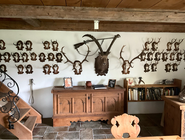
But that is not all. Following this very successful second campaign, we are now well on our way to setting up an open digital model database targeting the Alps; an important milestone for Alpine and rift Geology. None of this would have been possible without the great support I have gotten from the DEEP research school, CY Cergy Paris University (CY Initiative grant "Investissements d'Avenir" ANR-16-IDEX-0008), University of Oslo, NCCS (Research council of Norway grant 257579) & partners, and UNIS at all stages of the work. Neither would the campaign have been possible without the amazing hunter’s cabin/base of operations in La Punt that is provided by the Lautenbacher foundation.
An avid hunter and supporter of science and education, Mr. Laudenbacher dedicated this house to science and established the foundation after his passing. The lodge houses several personal collections that include rocks, minerals, and samples, as well as many of his hunting trophies, and sleeps up to 9 scientists. For those sharing an interest in Alpine geology it is important to note that the Laudenbacher lodge is available to all those wishing to study the Alps, with students paying as little as 10 SFR a night, depending on availability.