Nettsider med emneord «Geomatics»


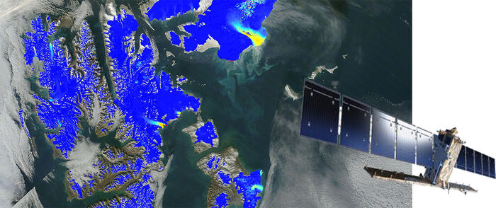
A large international study - Global Land Ice Measurements from Space (GLIMS) shows that Earth’s glaciers are shrinking with only a few exceptions. The scientists behind the study have applied satellite images to study the glaciers over the recent decades. The comprehensive report is now published as a book and an e-book.

► Measuring a changing Earth
To better monitor and understand Earth system processes and their impacts on human and natural systems, remote sensing and the analysis of geographical information play an increasingly important role in today's world. Remote sensing and geoinformatics are influential and versatile technologies for many fields and applications in society. We develop methods and applications of remote sensing and geomatics at the interface between natural sciences, technology, informatics, and society-relevant applications.