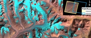
Thursday 15 December, San Francisco: In her lecture at AGUs fall meeting, Solveig Havstad Winsvold presented a new method to measure glaciers with satellite images from the Lansat program. She uses time series from the Landsat data.

Now her presentation and research with other colleagues at the Department of Geosciences, has been mentioned at NASA Sciences' websites.
Reference article:
Winsvold, S. H., Kääb, A., & Nuth, C. (2016). Regional Glacier Mapping Using Optical Satellite Data Time Series. IEEE Journal of Selected Topics in Applied Earth Observations and Remote Sensing, 9(8), 3698 – 3711.
In the news
Solveig Havstad Winsvold, PhD fellow, Department of Geosciences
See also
AGU. Fall Meeting, San Francisco 11-16 December 2016