
The PhD defence and trial lecture will be held in Auditorium 1 in The Geology Building. In some cases, it will be possible to attend the trial lecture and dissertation digitally, in that case a link to Zoom will be posted.
Trial lecture
Friday 22 September, 10:15-11:00, Aud 1, The Geology Building
Use of AI for data assimilation
Conferral summary (in Norwegian)
Satellittobservasjoner er viktige data i det globale observasjonssystemet og gir nøyaktig informasjon for værvarsling, spesielt for datasparsomme områder som Arktis. Imidlertid er bruk av satellittdata i numeriske værprediksjonsmodeller vanligvis utnyttet konservativt og ufullkomment. I denne doktoravhandlingen er det foreslått å bruke satellittobservasjoner mer konsistent i den anvendte værvarslingsmodellen, og å forbedre værvarslene ved å ta hensyn til fotavtrykket til satellittmålingen.
Main research findings
Popular scientific article about Mile’s dissertation:
Advanced assimilation of satellite observations in a limited-area numerical weather prediction model over the Arctic region
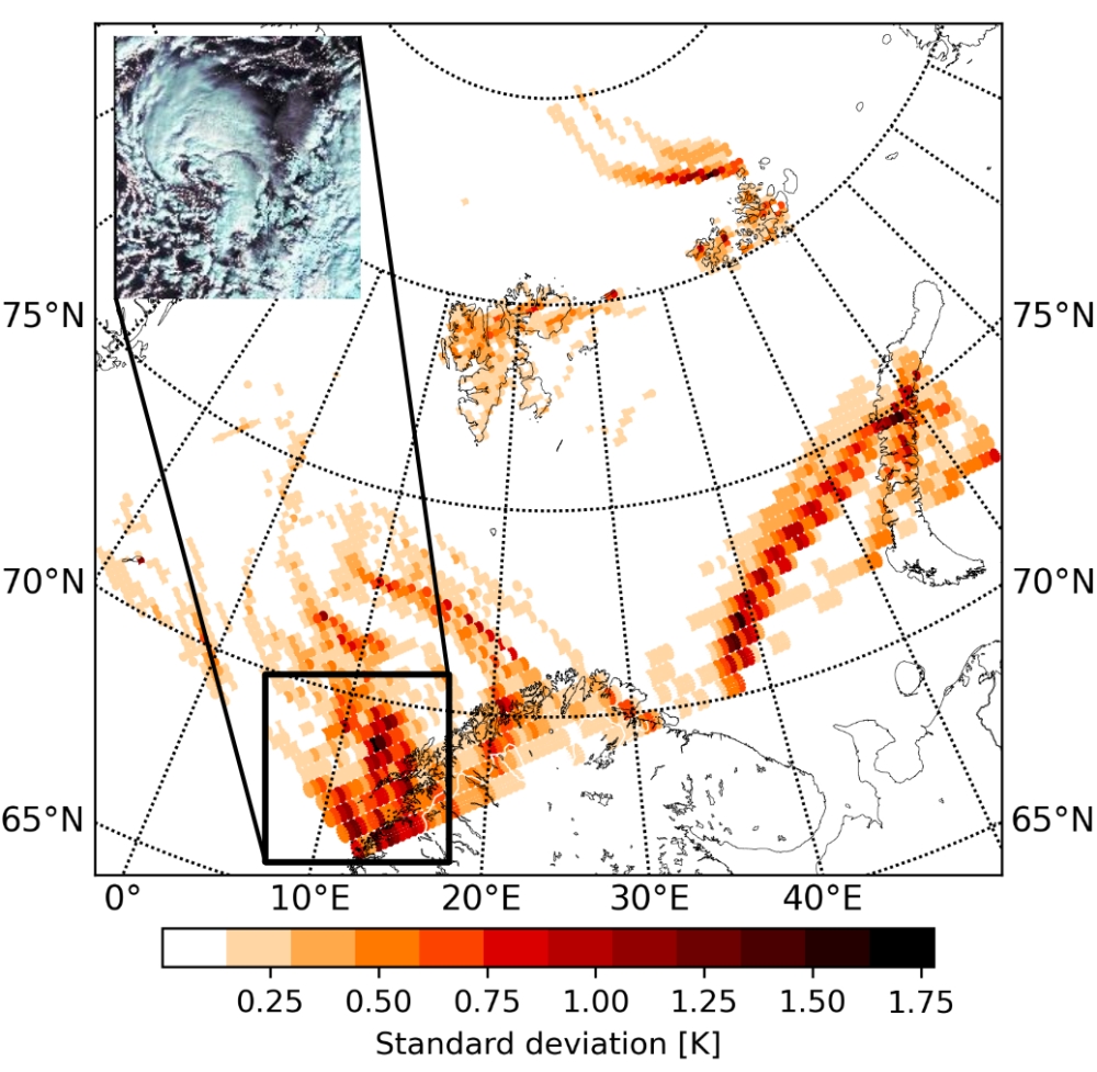
Satellite observations are our best sources for observing the Earth system and provide relevant information for everyday weather predictions as well. It is clear that over the Arctic, where conventional observations are usually sparse and numerical weather prediction models are less skilful, an accurate description of the atmospheric state is not achievable without satellite observations.

Therefore, data from satellites are integrated i.e., assimilated in the numerical models in order to keep the model on track with the true atmospheric state. However, the use of satellite observations is generally conservative and can include assumptions. For instance, satellite measurements are utilised as point observations which assumption is not optimal for state-of-the-art numerical models.
In this doctoral thesis, a more advanced use of satellite observations is studied when the spatial extension or representation of the satellite instrument is taken into account by the so-called footprint observation operators. The study has begun with a surface type of satellite observations and progressed towards more complex footprint representations of the area which is covered in the satellite observation. It is shown that the use of the footprint observation operator for utilising satellite observation data in a numerical weather forecast model leads to better exploitation of the observations and improves short-range forecasts over the Arctic domain.
Photo and other information:
Press photo: Máté Mile, portrait; 300px. Photo: Private
Other photo material: Figure with description and credit as specified in the article above, size 1000px.