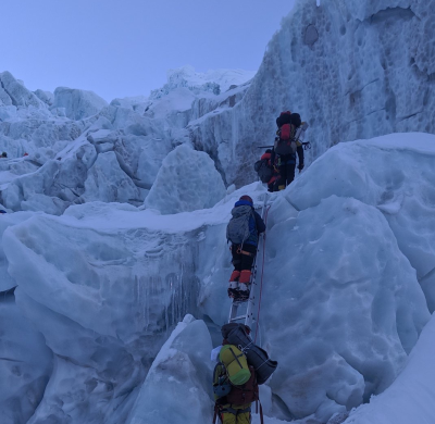
The Khumbu Icefall is on the Khumbu glacier, on the Nepali slopes of Mount Everest. The icefall is not far above Base Camp and is known as a large and dangerous obstruction on the way for mountaineers to ascend Mt. Everest in the Himalayas.
The new detailed velocity mapping of the Khumbu Icefall can be of help for the local climbers (called ice-doctors) that each year establish a route with ladders and ropes for the other international climbers.
From the detailed velocity map one can see regions of shear, where a lot of crevasses are born. Conversely, the researchers were helped by high-altitude mountaineers to validate their velocity map.
Reference:
Altena, B., Kääb, A. 2020. Ensemble matching of repeat satellite images applied to measure fast-changing ice flow, verified with mountain climber trajectories on Khumbu icefall, Mount Everest. Journal of Glaciology, Open Access article, DOI: https://doi.org/10.1017/jog.2020.66