About the project
A state-of-the-art laboratory project for unraveling volcanic processes behind geodetic measurements. In the project we want to gain knowledge of the processes in form of ground movements in the body of the vulcano leading to the deformation field of the vulcano. This is done with use of simulations of different deformation processes.
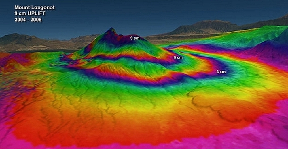
Geodetic methods have become widespread techniques to monitor ground movements on active volcanoes worldwide. These ground movements reflect the dynamics of the underlying volcano plumbing systems, and proper interpretation of these ground movements is crucial for assessing volcanic hazards. A classic geodetic approach is to apply inversion theory: the monitored ground movements are inverted using simple geodetic models.
The results of the inversion provide the depth, size and shape of the volcanic conduit responsible for the measured ground movements. However, several problems arise from this approach, among other: (1) the solution of the inversion is not unique, (2) the relevance of the inversion results cannot be tested as the volcanic conduit is still buried, and (3) the effects of the assumptions in the geodetic models commonly used have not been quantified.
Objectives
The aim of the project is to use a state-of-the-art laboratory apparatus designed at Physics of Geological Prosesses (PGP) that (1) simulates shallow magma emplacement, (2) monitors ground movements associated with magma emplacement through time, (3) monitors the pressure of the intruding magma and (4) quantifies the full 3D shape of the magma conduit.
This apparatus will be the foundation of the project to: (1) test the robustness of existing geodetic models, (2) quantify the effects of the assumptions in geodetic models, and (3) test the possibility to use geodetic data as forecasting tool for volcanic eruptions.
Financing
The project is financed as a 4-year PhD position by the Faculty of Mathematic and Natural Sciences at the University of Oslo (Grant ref: 2014/3384, 100%, PhD Research Fellowship in Experimental Geophysics, GEO, SI31).
The Ph.d. project was finished in the autumn of 2019 with the dissertation: "Beyond Elasticity - An Experimental Study of Magma Emplacement Mechanisms and Associated Deformation Structures"
Cooperation
The project is part of the research group Physics of Geological Processes (PGP), which is an interdisciplinary research group involving researchers from both the Department of Physics and the Department of Geosciences, University of Oslo.
The Laboratory Volcano Geodesy project involves an active international collaboration with Rikke Pedersen from Nordic Volcanological Center at the University of Iceland in Reykjavik.
- Nordic Volcanological Center, University of Iceland
