Introduction:
Machine Learning (ML) is now being used in earth sciences to infer lithology, sedimentary facies, porosity, and fluid saturation as functions of wireline logs and core data. Deep Learning is being used for automated seismic interpretation of both structure and stratigraphy.
We can now apply these methods at a basin scale, using multiple datasets to study architecture and geological history of basins. ML and data science, in general, are promising to transform the subsurface workflows in the oil industry and is likely to play a key role also in academic geoscience research.
Aims:
The aim of the study is to train and use ML models to predict faults, their geometric attributes such as length, height, lateral/vertical segmentation and linkage, in multiple seismic volumes across a basin, and to verify the accuracy of these models.
Data and method:
Several seismic surveys and well data from a basin of interest within the Norwegian Continental Shelf will be selected for this study. The students will train and apply ML models on these data to interpret faults and lithostratigraphic units. Well data will be used for seismic to well tie analysis and to predict rock properties in the boreholes.
Research tasks:
ML-based fault attribute volumes and lithostratigraphic volumes (stratigraphic formations and geo bodies) will be generated for each seismic survey using EarthNET (Earth Science Analytics’ platform).
Automated ML fault imaging will be carried out using pre-trained models of synthetic examples as well as models based on human-labelled faults on seismic surveys.
The ML-based fault attribute volumes will be compared with human-labelled faults to verify the quality of fault geometric data extracted from ML-based fault volumes.
Lithostratigraphy will be predicted by ML models that are trained on labelled data from seismic lines tied to wells where the formation tops are known.
Geobodies will be predicted by ML models that are trained on human-labelled data from selected seismic lines.
Learning outcomes:
- You will learn how to perform a research project.
- You get involved in planning the research, seismic data selection, seismic-to-well tie, labelling interfaces, and faults on seismic data, analyzing the data using different ML to build fault and lithostratigraphic volumes, writing, and illustrating your results in the form of your thesis.
- You will get familiar with analyzing subsurface data such as reflection seismic data as well logs and check-shot data and well reports.
- You will learn to use the EarthNET platform from Earth Science Analytics, which enables automatic interpretation of faults, lithostratigraphy and geobodies from seismic data.
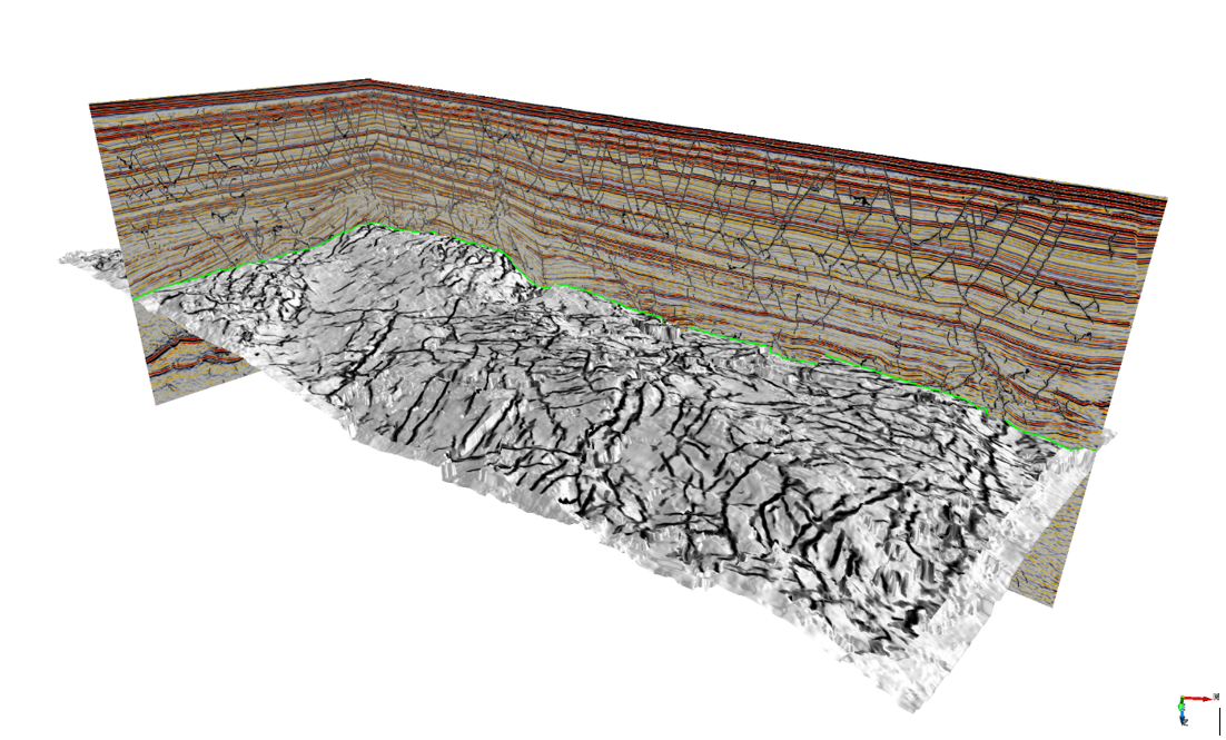
Figure 1. Seismic and imaged fault data using deep learning ML algorithm. The surface shows the fault attribute data draped on a two-way time map.