Two master students from the University of Oslo (UiO), Department of Geosciences, to work together on two separate master subjects, with supervision from NGI, SLF, and Geo-hazard Advisors, in addition to the formal contact with UiO.
The subject is on various aspects of debris flows, and some ideas are given below. However, the exact focus of each thesis is to be defined among the student and the supervisors and will also be partly based on the student’s background.
Background:
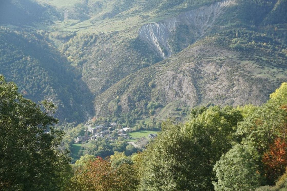
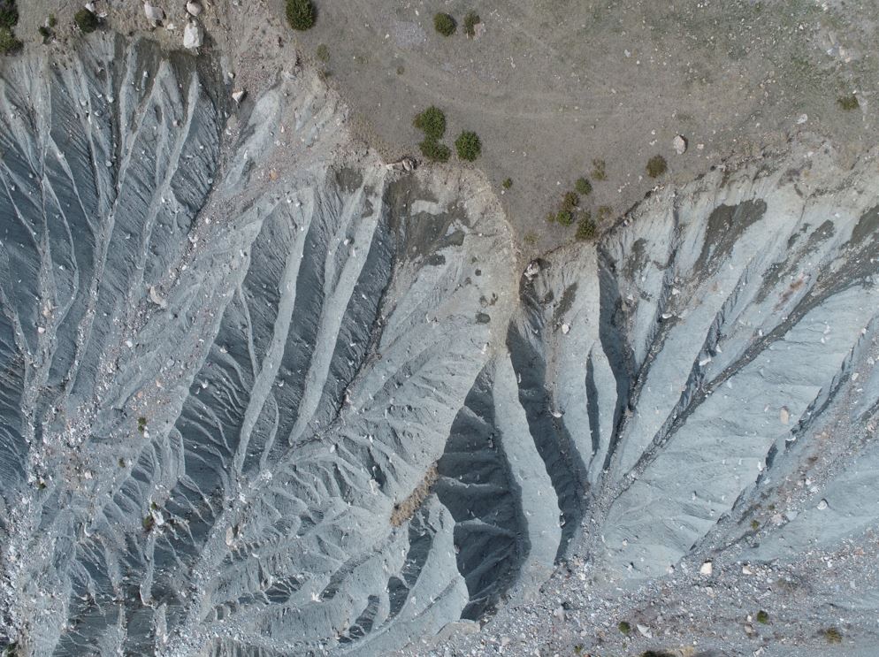
The Erill-la-Vall site is part of the H2020-Phusicos project (2018-2023) but has been investigated as part of a PhD (Raïmat, 2018) from 2007. The debris flows are sourced from a thick (55m) till deposit, prone to erosion by heavy precipitation. Debris flows from several gullies can merge and threaten the downstream village of Erill-la-Vall. Erosion caused by heavy precipitation causes erosion and shallow landslides and debris flows.
However, there are also deeper movements, at around 20m depth, which also seem to be triggered by precipitation, but with a 10-15 days delay after the precipitation event.
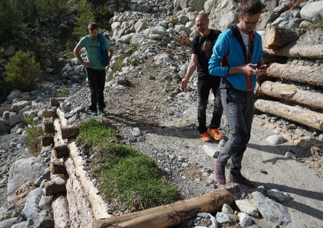
Old measures comprise a gabion dam, a concrete dam, and a flexible barrier (debris flow net), which all were filled up. The Phusicos NBS measures (Nature Based Solutions) are vegetated terraces, partly built by timber (Krainer crib walls) and local stones, in the lower parts of the two main gullies. Another flexible barrier is also planned, downstream of the Krainer walls. Together, these measures will reduce the energy of debris flows and prevent further lowering of the level of erosion.
The site has been monitored over several years, and the monitoring includes the following:
- 5 Piezometers at 3-to-37-meter depth in a 55m deep borehole, behind the back scarp
- A minutal pluviometer
- A microseismic network (4 geophones)
- Flow height measurements
- Turbidity measurements in the gully
- Physical visits with drone flights (Lidar and photography), regularly and after events
All the monitoring data will be available for the MSc theses.
Possible thesis subjects. (To be defined with the students and many subjects can be combined):
- The connection between weather elements and stability:
- Analyse all weather data from the location, as well as regional data, and compare with known instability events. Compare to the monitored piezometer data.
- Model the Factor of Safety (FS) for various precipitation scenarios.
- Assess future climate and the development of stability through this century.
- Implemented NBS, their effect and lessons learned from this.
- Use of the microseismic network:
- Assess seismicity regionally and within the local microseismic network.
- Use geophone data to assess the time and velocities of debris flows, both for run-out modelling and for correlation with weather data.
- Debris flow dynamics:
- Analysis of the impact forces on the flexible barrier and correlation to debris flow volume, height and velocity.
- Use of DEM to evaluate debris flow erosion along the channel. A key question will be to assess how boulders are entrained by the debris flow.
- Other potential topics, which can be combined and / or included in the above:
- Effect of vegetation in the gullies (the ultimate aim is that vegetation will re-establish in the entire area with time). FS with and without vegetation.
- The short/medium/long-term effect of the implemented NBS measures, including the vegetation. Possible change in response as measured with regular LIDAR surveys?
- Modelling the implemented terraces and the effect of continued terracing up and downstream.
- Extrapolation of the data and results from Erill to other glacial till deposits which are causing debris flow problems in other parts of the same valley (Taüll, Boí. Barruera, Cardet i Durro)
- The final set-up and optimisation of an automated warning system.
Students’ background and skills:
- The most important skill is being able to see possibilities, be creative, and work independently!
- General Geoscience background, with basic knowledge of geohazards
- One or a combination of:
- GIS for mapping and analysis
- Geophysics
- Hydrology/hydrogeology
- Statistics
- Modelling and coding
What skills will the student learn/gain?
- A broad and varied understanding of precipitation-driven landslides
- The use of a variety of monitoring techniques to set up warning systems
- The effect and possibilities of various mitigation systems, including NBS
- An international network