Understanding surface water-groundwater interactions is crucial for effective water management. Groundwater is a common source of drinking water supplies, and examining these interactions is important to ensure sustainable usage and prevent potential contamination.
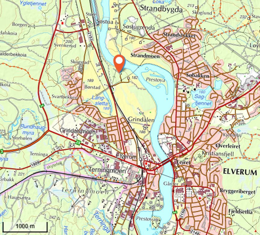
The water supply of Elverum comes from the Grindalsmoen aquifer. Approximately 6 million litres of groundwater are extracted daily from four groundwater wells at the Elverum waterworks, located about 100 metres southwest of the Glomma River (Figure 1). Despite several previous studies characterizing and monitoring the Grindalsmoen aquifer, our understanding of the interactions between the river and the aquifer remains incomplete with uncertainties in the origin of the pumped water.
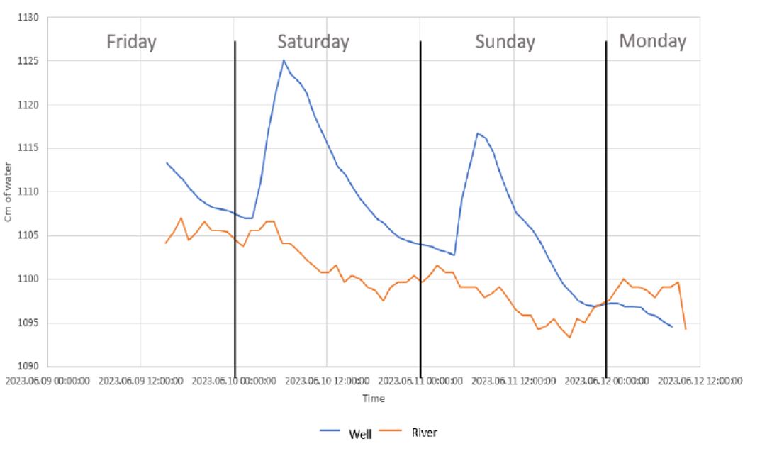
This master thesis aims to evaluate the relationship between the stages of the Glomma River and the groundwater level fluctuations in the Grindalsmoen Aquifer (Figure 2), using field methods and groundwater models (analytical solutions and numerical models), and addressing the following questions:
- How well is the aquifer connected to the river?
- What factors (hydraulic conductivity, pumping rate, river stage) affect this relationship?
- Which analytical solution(s) is best suited for the transient stream-aquifer interaction, and what constraints do the geological conditions and the aquifer type put on the available and suitable solutions?
The project contains both fieldwork and groundwater modelling. It will give the student a good experience in surface water-groundwater interactions and the tools frequently used in professional environments for groundwater resource management.
Click here for a bigger version.
Click here for a bigger version.